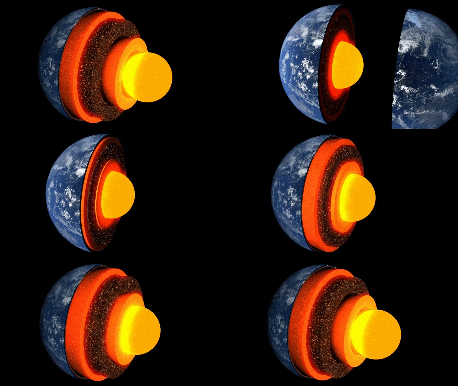

Animazione degli strati della terra.
Una nuova ricerca condotta dall’Università di Cambridge è la prima a ottenere un'”immagine” dettagliata di un’insolita sacca di roccia nello strato limite con il nucleo terrestre, a circa tremila chilometri sotto la superficie.
La misteriosa regione rocciosa, situata quasi direttamente sotto le isole Hawaii, è una delle numerose regioni a velocità molto bassa, così chiamata perché le onde del terremoto rallentano fino a strisciare mentre le attraversano.
Ricerca pubblicata sulla rivista il 19 maggio 2022 Comunicazioni sulla naturaè il primo a rivelare in dettaglio la complessa asimmetria interna di una di queste enclavi, facendo luce sui profondi paesaggi interni della Terra e sui processi che operano al loro interno.
“Di tutte le profonde caratteristiche interiori della Terra, questa è la più meravigliosa e complessa.” – come me
“Di tutte le caratteristiche interne profonde della Terra, questa è la più affascinante e complessa. Ora abbiamo ottenuto la prima solida prova per mostrare la sua struttura interna: è un vero punto di riferimento nella sismologia profonda”, ha affermato l’autore principale Zhi Li, uno studente di dottorato presso il Dipartimento di Scienze della Terra a Cambridge. ground”.
L’interno della Terra è formato come una cipolla: al centro c’è il nucleo di ferro e nichel, circondato da uno spesso strato noto come mantello, e sopra di esso una sottile crosta esterna – la crosta su cui viviamo. Sebbene il mantello sia una roccia solida, è abbastanza caldo da scorrere molto lentamente. Le correnti di convezione interna alimentano il calore in superficie, provocando il movimento delle placche tettoniche e alimentando le eruzioni vulcaniche.
Gli scienziati usano le onde sismiche dei terremoti per “vedere” cosa c’è sotto la superficie terrestre: gli echi e le ombre di queste onde rivelano immagini simili a radar delle profondità interne. Ma fino a poco tempo fa, le “immagini” delle strutture al confine tra nucleo e mantello, una regione di primario interesse per lo studio del flusso di calore interno del nostro pianeta, erano sgranate e difficili da interpretare.

Gli eventi e le traiettorie dei raggi Sdiff utilizzati in questo studio. a) Una sezione trasversale che attraversa il centro della regione a velocità ultrabassa alle Hawaii, che mostra le traiettorie dei raggi per le onde Sdiff a 96°, 100°, 110° e 120° per il modello 1D PREM Earth. Le linee tratteggiate dall’alto verso il basso indicano le discontinuità di 410 km, 660 km e 2.791 km (100 km sopra il confine nucleo-mantello). b) Eventi e traiettorie dei raggi Sdiff sul modello di tomografia di fondo SEMUCB_WM1 a una profondità di 2791 km. Palloni da spiaggia per eventi dipinti in diversi colori tra cui 20100.320 (giallo), 20111214 (verde), 20120417 (rosso), 20180910 (viola), 20180518 (marrone), 20181030 (rosa), 20161122 (grigio), stazioni (triangoli) , e raggi. Traiettorie delle onde Sdiff a una profondità del foro di 2791 km nel mantello inferiore utilizzate in questo studio. L’evento utilizzato nell’analisi di breve periodo è evidenziato in giallo. La posizione ULVZ proposta è mostrata in un cerchio nero. La linea tratteggiata mostra la sezione trasversale disegnata in A. Credit: Nature Communications, DOI: 10.1038/s41467-022-30502-5
I ricercatori hanno utilizzato metodi di modellazione numerica all’avanguardia per rilevare strutture su scala chilometrica al confine tra nucleo e mantello. Secondo il coautore Dr. Kuangdai Leng, che ha sviluppato i metodi mentre era a[{” attribute=””>University of Oxford, “We are really pushing the limits of modern high-performance computing for elastodynamic simulations, taking advantage of wave symmetries unnoticed or unused before.” Leng, who is currently based at the Science and Technology Facilities Council, says that this means they can improve the resolution of the images by an order of magnitude compared to previous work.
The researchers observed a 40% reduction in the speed of seismic waves traveling at the base of the ultra-low velocity zone beneath Hawaii. This supports existing proposals that the zone contains much more iron than the surrounding rocks – meaning it is denser and more sluggish. “It’s possible that this iron-rich material is a remnant of ancient rocks from Earth’s early history or even that iron might be leaking from the core by an unknown means,” said project lead Dr Sanne Cottaar from Cambridge Earth Sciences.

Conceptual cartoons of the Hawaiian ultra-low velocity zone (ULVZ) structure. A) ULVZ on the core–mantle boundary at the base of the Hawaiian plume (height is not to scale). B) a zoom in of the modeled ULVZ structure, showing interpreted trapped postcursor waves (note that the waves analyzed have horizontal displacement). Credit: Nature Communications, DOI: 10.1038/s41467-022-30502-5
The research could also help scientists understand what sits beneath and gives rise to volcanic chains like the Hawaiian Islands. Scientists have started to notice a correlation between the location of the descriptively-named hotspot volcanoes, which include Hawaii and Iceland, and the ultra-low velocity zones at the base of the mantle. The origin of hotspot volcanoes has been debated, but the most popular theory suggests that plume-like structures bring hot mantle material all the way from the core-mantle boundary to the surface.
With images of the ultra-low velocity zone beneath Hawaii now in hand, the team can also gather rare physical evidence from what is likely the root of the plume feeding Hawaii. Their observation of dense, iron-rich rock beneath Hawaii would support surface observations. “Basalts erupting from Hawaii have anomalous isotope signatures which could either point to either an early-Earth origin or core leaking, it means some of this dense material piled up at the base must be dragged to the surface,” said Cottaar.
More of the core-mantle boundary now needs to be imaged to understand if all surface hotspots have a pocket of dense material at the base. Where and how the core-mantle boundary can be targeted does depend on where earthquakes occur, and where seismometers are installed to record the waves.
The team’s observations add to a growing body of evidence that Earth’s deep interior is just as variable as its surface. “These low-velocity zones are one of the most intricate features we see at extreme depths – if we expand our search, we are likely to see ever-increasing levels of complexity, both structural and chemical, at the core-mantle boundary,” said Li.
They now plan to apply their techniques to enhance the resolution of imaging of other pockets at the core-mantle boundary, as well as mapping new zones. Eventually, they hope to map the geological landscape across the core-mantle boundary and understand its relationship with the dynamics and evolutionary history of our planet.
Reference: “Kilometer-scale structure on the core–mantle boundary near Hawaii” by Zhi Li, Kuangdai Leng, Jennifer Jenkins and Sanne Cottaar, 19 May 2022, Nature Communications.
DOI: 10.1038/s41467-022-30502-5


